Langruth Flood 2011
Lakeview Flooding:
May 12, 2011: If the Lake level rises to 815.5 feet, click here to see which area of Big Point and the shore line will be flooded.
Lake Manitoba Residents Speak Out In Langruth, June 2, 2011... click here
Youtube Videos:
Destruction of Lake Manitoba (14 minutes)
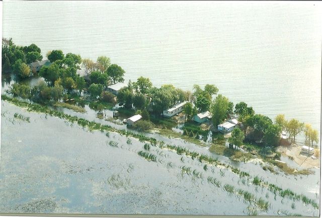
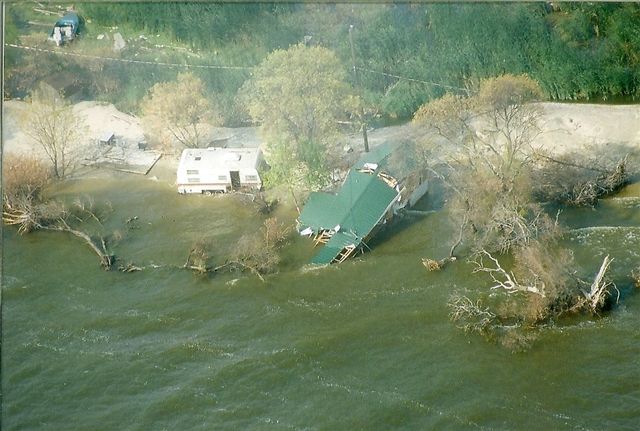
Aerial video of Big Point flood, June, 2011...you have to click on the
link in the next page.... click here Video#2 Video#3
May 12, 2011: If the Lake level rises to 815.5 feet, click here to see which area of Big Point and the shore line will be flooded.
Lake Manitoba Residents Speak Out In Langruth, June 2, 2011... click here
Youtube Videos:
Destruction of Lake Manitoba (14 minutes)
Aerial video of Big Point flood, June, 2011...you have to click on the
link in the next page.... click here Video#2 Video#3
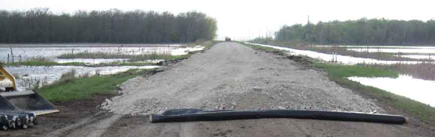
Raising Big Point Road 18" between Ingumundson's and Darrel Armstrong's - May 27,2011. (photo by Barry Arksey)
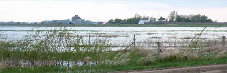
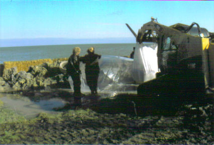
Flooding by Joe Johnson's - May 27,2011. (photo by Barry Arksey)
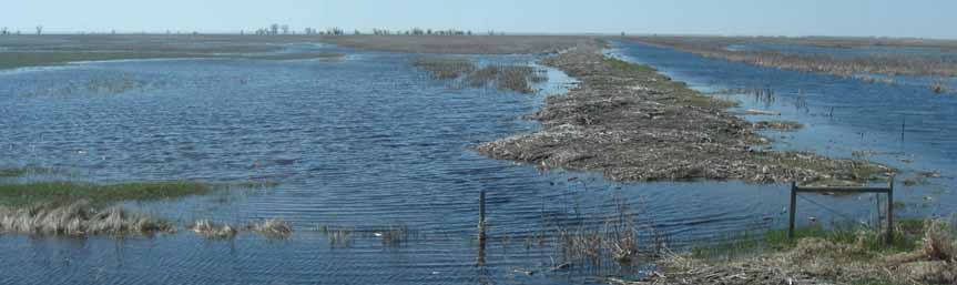
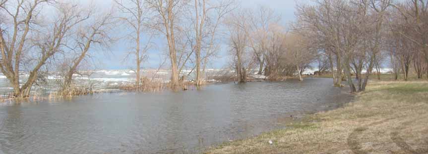
Lake floods into fields south east of Mark Ingumundson's old place off of Big Point Road. (pictures taken by Barry Arksey)
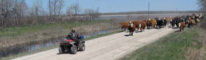
Tom Teichroeb drives his cattle from flooding lake area to drier pastures west of town.
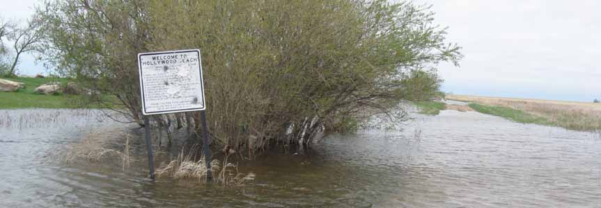
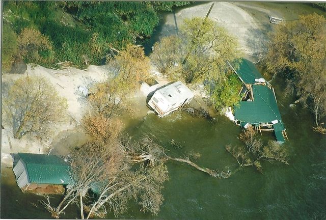
And more pictures taken by Sylvia Huyber of the Hollywood Beach....
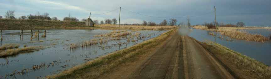
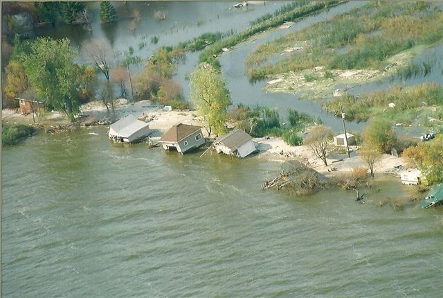
and one taken by Sylvia at the end of the Big Point Road....
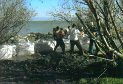
Sandbagging at Big Point Retreat (photos by Keith Johnson)
Big Point Retreat Pictures (photos by Sherree McLenehan) ... click here
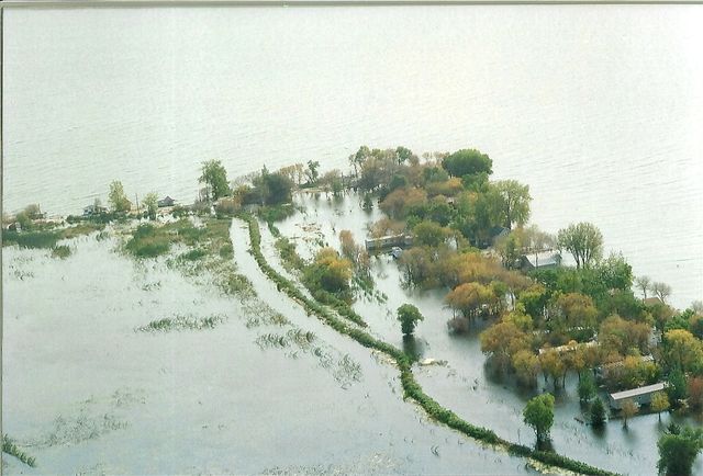
Map of flooded area... click here
Lake Manitoba levels... click here
Joe Johnson and Tom Teichroeb on CTV News - May 30, 2011... click here
New flood channel proposed from Lake Manitoba to Lake Winnipeg... click here
Assistance plan unveiled... click here
Map of flooded area... click here
Lake Manitoba levels... click here
Joe Johnson and Tom Teichroeb on CTV News - May 30, 2011... click here
New flood channel proposed from Lake Manitoba to Lake Winnipeg... click here
Assistance plan unveiled... click here
